 | ||
| Equipment: Canon 5D Mark 2, Canon 100-400mm | ||
| Image details: 200mm, f/8, 1/500sec, ISO 400 |
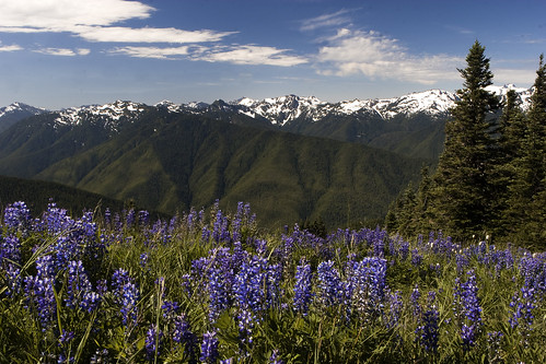
Hurricane ridge is about an hours drive from Port Angeles. There is a visitor center at the bottom on the ridge and also at the top of the ridge. The visitor center at the bottom of the ridge is larger and also has a naturalist display that is very interesting. The winding road to hurricane ridge has numerous vista points where you can pull off the road and enjoy spectacular views of the Strait of Juan De Fuca. On a clear day you can see Mt Baker and the Dungeness spit lighthouse.
Spring is one of the best times to shoot at the ridge - its wildflower season and the Lupines and Avalanche lilies are in full bloom. There is a the short hike to hurricane hill from the parking lot. All along the trail you will be treated to sweeping panoramic views of the Olympic mountains. I like to use the lupines as foreground to compose some shots of the Olympic mountains. In summer the best time to shoot is before 8 am or after 8 pm. In early morning sometimes a fog drifts in which can make for some interesting compositions. For more information about the trails around hurricane ridge refer to the following website.
 | ||
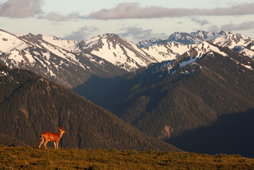
| Equipment: Canon 5D Mark 2, Canon 100-400mm | ||
| Image details: 400mm, f/5.6, 1/500sec, ISO 400 |
A wide to medium zoom is very useful for this shot - I most commonly use my Canon 24-70 at this spot. I like to use a longer lens like the Canon 100-400 to isolate the deer against the ridge. The ridge is usually windy at the best of times, I always carry a windbreaker and a cap.
The obstruction point road starts from the top of hurricane ridge. This is a narrow single lane dirt road with a steep drop off on the side. This is not for the light of heart! I have heard from friends that there is a Marmot colony at the end of the road but not been there myself.